← Back to Projects
Tree Folio NYC
New York City, 2023
A digital twin of NYC's urban canopy, demonstrating the impact of local environments on a trees shading potential.
Heat vulnerability, like many aspects of climate change, is experienced at a local level. A residents access to air conditioning, the quality of building envelopes, and the availability of shade are all factors in an individuals exposure to extreme heat. In addressing the growing impacts of climate change, urban trees should be thought of as part of a distributed shading infrastructure that mitigates extreme heat. For decades this infrastructure has been inequitably distributed, guided by policies that encourage urban beautification and economic development. In evaluating urban canopies in relation to climate change we need to better understand what influences the benefits that trees provide. The availability of shade in a local site depends on both the number of trees in a neighborhood and the quality of shade those trees provide. Shade quality is heavily influenced by the relationship between a tree and its local context, including the orientation of the street and the height of neighboring buildings.
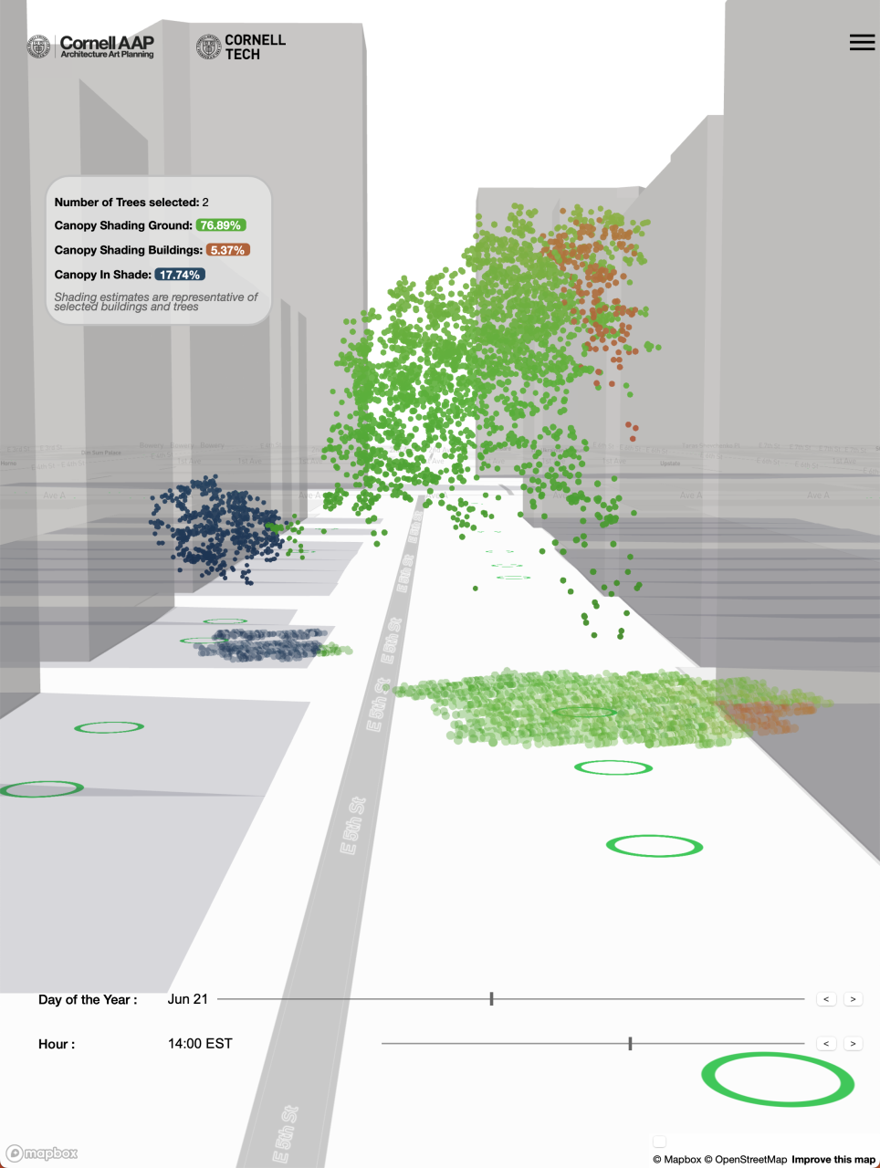
Tree Folio extracts 3d models of urban trees in NYC from publicly available LiDAR data repositories, simulates their local shading environments, and quantifies the amount and quality of shade each tree provides. These tools represent a novel way of understanding trees local shading impact and new methods of communicating these impacts to policy makers and the public. The goal of this research is to inform planting strategies that are responsive to local vulnerabilities, and add up to have the maximum impact in mitigating climate effects at the city-scale and that can be applied to cities of all sizes.
Making the most of distributed assets, such as street trees, is critical. For all the benefits trees provide, planting initiatives require money, labor, embodied energy and corresponding emissions, and community goodwill. Poor planting strategies could have higher failure rates and could fail to deliver the impacts desperately needed by the cities most vulnerable populations. Creating tools to better understand urban tree models based on the dynamic relationships between hyper-local city elements is essential to develop strategies that are responsive to local needs and add up to have the maximum effect in mitigating climate effects and for all aspects of the future ‘climate changed’ city.
Tree Folio NYC is a research project by the Design Across Scales Lab at Cornell AAP, funded and in collaboration with the Jacobs Urban Tech Hub at Cornell Tech.
Project Team:
Alexander Kobald (Project Lead, Design Across Scales Lab, Cornell AAP)
Joe Ferdinando (Research Assistant, Cornell University)
Sarang Pramode (Research Assistant, Cornell Tech)
Jiahao Dong (Research Assistant, Cornell Tech)
Guangwei Jiang (Research Assistant, Cornell Tech)
Anthony Townsend (Advisor, Urban Tech Hub, Cornell Tech)
J. Meejin Yoon (Advisor, Design Across Scales Lab, Cornell AAP)
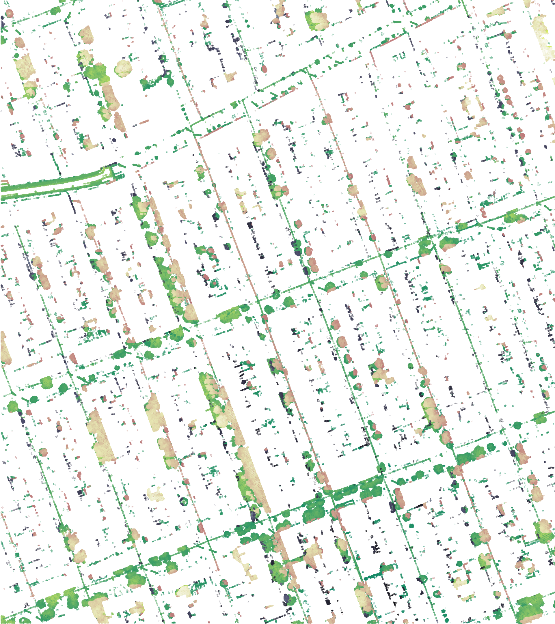
Urban canopy, like many forms of infrastructure, has been deployed unevenly, exacerbating the inequalities in the city and disproportionally exposing lower income communities to the effects of extreme heat and the risks of climate change. We used an early version of our tool to examine tree canopies in two neighborhoods in NYC. Park Slope in Brooklyn (above) has large trees, distributed evenly producing a dense canopy with beneficial shade on most streets regardless of street orientation.
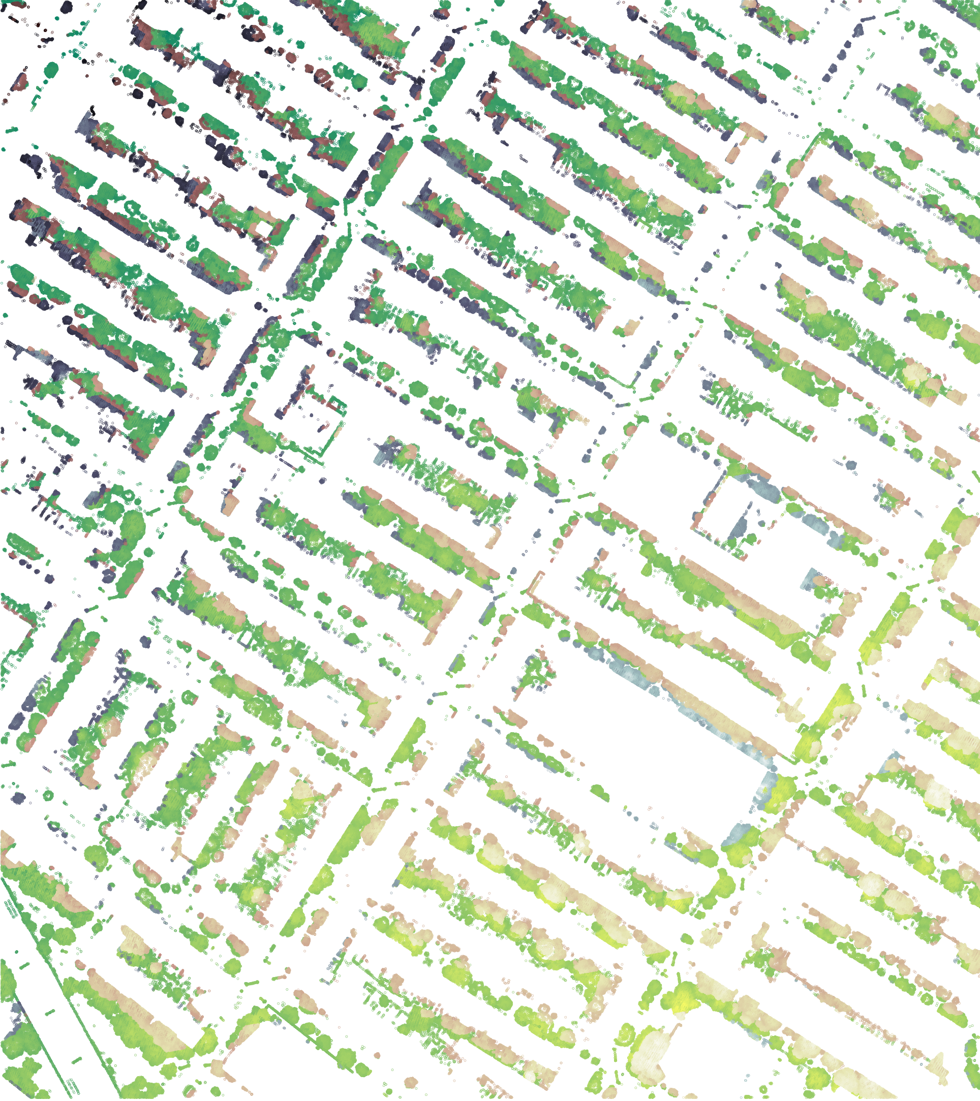
Ozone Park in Queens (below) has similar numbers of trees but less equitably distributed and much less healthily developed. The lack of shade is exacerbated by the street orientations (shown by the red and black shaded canopies), leaving the north-south street orientations especially exposed to afternoon summer heat.